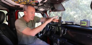
Summary of a helpful 14-minute YouTube Video by TrailRecon
Brad answers questions on navigation systems, hardware and mounts.
“I thought today would be a great opportunity to just sit down take a minute and let’s just discuss what I’m using, why I like using this and why I kind of keep coming back to this because I have tried a few other things over the years.”
He’s not being paid. “This is what I genuinely prefer to use.”
When they first started out, they were using maps, compasses, books and phones. “But if you’re going to be doing this a lot, like I do, having a dedicated system where you can record, track, mark waypoints and make sure you don’t get lost is extremely invaluable.”
WHAT HE’S USING
An iPAD MINI
“The important thing is it needs to have cellular capability.” That feature gives you GPS. The Wi-Fi version doesn’t have built in GPS. He doesn’t have a cell phone plan for it, but he links it with his phone. If your budget allows, he thinks the cellular plan “makes a lot of sense.”
The iPad Mini is lightweight and easy to charge. “The charger that I’m using charges both my phone and the iPad, so I can switch back and forth – which is really really perfect for me.”
A RAM© EZ-Roll’r™ MOUNT.
They’re not very expensive so he has three. “Once you get this where you want it, you don’t really want to move it around.”
He shows how he has his mounted. “It holds the iPad very very securely.”
He discusses attaching to a 1” ball and the flexibility of the 67 designs arm. “You can rotate this is any different direction you want… plus they sell different sizes of arms.”
When it comes to road vibration – unlike other systems – “this is rock solid.”
“I really like how durable this is because when you’re going down a nice bumpy washboard road for many miles and you’re trying to see your navigation, it’s sitting there shaking it can be really annoying; so this is Rock Solid in here and I really like that.”
The 20mm ball is on his Vector e doc Contour mounting system.
Brad confesses to having “all kinds of things mounted on here, but it allows you a lot of versatility.”
THE APPS
His primary app is the GAIA GPS.
“I’ve been using Gaia GPS for years. In fact, if you look here, I have so many tracks, so many waypoints, so many things that I’ve uploaded and recorded, and I just have so much information in here it makes it hard for me to transition to something else.”
He really likes that it’s easy to record, easy to upload GPX files and it’s really intuitive to add waypoints and information.
It has a lot of map overlays. He uses the Overland map overlay, the forest fire, snow depth, Nat Geo and history.
TRAILSOFFROAD – “These are trails that have been explored and documented and you can upload the files … directly from Trails Offroad to Gaia. It’s seamless, you just click one button.”
“Their app in general just works great.”
“ONYX OFFROAD has some really good assets. Again, it syncs between your phone and your computer. You can plan routes, you can upload GPX files … It also has really good information about trails.”
“It’s a little more comprehensive” than Gaia.
“I also like that it has good information about public lands and private lands. It basically tells you very clearly whose land ownership you are on and that is a very valuable tool.”
THESE APPS CHARGE FEES
He subscribes to all three.
“Just figure out which one works best for you and use that.”
OTHER APPS
He uses the GARMIN TREAD APP because he has “the big 10 inch Garmin Tread Navigation system on its own standalone big tablet … It is a dedicated satellite navigation system that has all the maps in there and a lot of information. It’s great!”
However, “For me, though, it was just a little too big, it was a little too bulky and it didn’t allow me the opportunity to use some of the other things that I like to have in an iPad. I mean, look; an iPad just does a lot of other stuff besides navigation.”
“GOOGLE MAPS is a great asset for finding roads and sometimes some good forest roads or more well-known trails… Make sure you download the area that you’re going to be in for offline use; Google Maps has that feature.”
Make sure you have a good WEATHER APP.
BOTTOM LINE
“There is no substitute for knowing how to use a map and a compass. You really shouldn’t hit the trails without having those assets and knowing how to use them.”
Brad welcomes your questions, comments and recommendations.
![Amanda Products [USA] Logo](https://amandaproducts.com/wp-content/uploads/2017/04/aplogo_nonretina.png)
